
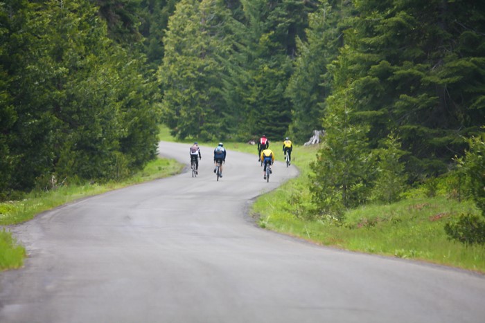
THE CASCADE SISKIYOU SCENIC BIKEWAY is our consistent Up & Down route of 49 miles and 4900 feet of climbing. Designated in 2015 by the State of Oregon, it is the first Scenic Bikeway in Southern Oregon and is one of the “the best of the best” in the state.
From Emigrant Lake, cyclists have a leisurely 5 miles before the road starts climbing in S-curves into the Cascades. Riders will enjoy a break and water stop a few miles up the strenuous 7-mile Greensprings climb. At mile 14, the rest stop at The Green Springs Inn will offer weary riders a grassy picnic area and extensive breakfast foods. Riders will enjoy spending a few minutes reliving their recent exertions. Another rest stop at Howard Prairie Resort (mile 25) will be well-stocked with offerings to replenish the efforts of the morning so far. Finally the climbing is over at the Dead Indian Memorial Road summit (mile 33), where we will offer a water break and encouragement before the final steep, winding, exhilarating descent.
The Up & Down is not a ride for the faint-hearted. Although only 7 miles, the Greensprings climb averages 7% grade and totals 2270’. The road is narrow with steep drop-offs and camera-worthy views. Having conquered the biggest climb, you still have 2800’ more of less strenuous climbing until the Dead Indian summit. Finally the glorious views on the 13-mile twisty, narrow Dead Indian descent will take your breath away. You will be supremely ready for delicious bar-b-q and craft beer at the finish.
View Scenic Bikeway Route
THE BURTON FLAT, our longer ride this year, was a big hit in 2017. Slightly changed, it is 80 miles and 6747′ of climbing on out back Forest Service and BLM roads, all paved but in some cases 1-lane, winding through the spectacular Cascades. Riders will leave Emigrant Lake and climb 12 miles to the Greensprings summit and the first, spectacular food stop on the lawn at the Green Springs Inn. For the next 40 miles you will wind around lakes and through forests with a glimpse of Mount Shasta, cross the Pacific Crest Trail twice and manage twists and turns on narrow roads. You will h ave two more rest stops with abundant food to replenish the weary. Finally at mile 55, you’ll rejoin Dead Indian Memorial Road for the last long 3-mile pull to the summit at mile 63. After a stop for water and a breather, riders will still have the exhilarating DIMR descent back into the Bear Creek Valley, as well as a hearty lunch and craft beer at Emigrant Lake.
View Burton Flat Route
THE BURTON FLAT LOOP, at 42 miles and 2585′, is mostly the Burton Flat route except without the climb up the Greensprings and the last descent on Dead Indian Memorial Road. Riders will drive to Howard Prairie Resort for the start and drive back to Emigrant Lake for lunch after the finish. You will ride out of the resort for 2 miles and meet the Burton Flat route at Howard Prairie Dam Road. From there you will enjoy narrow, rolling, twisty roads through woods and prairies, across creeks and the PCT, with two food stops. At mile 38, you will turn back onto Hyatt Prairie Road for 4 miles back to the resort.
Of course, riders are welcome to meet up with friends riding the Burton Flat for a fun way to enjoy the mountains without the pain.
View Burton Flat Loop Route
FULL SUPPORT includes three rest stops and two water stops as well as SAGs along the way. We have several vehicles on the routes, including Jackson County Search & Rescue trucks. They all carry a first aid kit and a bike pump and will give any rider a boost along the way. Our local Bear Creek Bicycle shop will be set up at the start for any mechanical issues and also SAGs part of the course, for immediate and extensive mechanical assistance.